Interactive World Maps

Interactive World Maps 2.5

Vous n'avez pas l'autorisation de télécharger
Description courte
Create interactive maps with colorful markers using this WordPress plugin. Show over 100 different regions including continents, countries, and states. Customize by coloring areas or adding custom markers.
12202218_04.webp

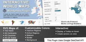
This is a Wordpress plugin to create as many maps as you want, with interactive and colored markers, continents, countries or regions.
(Check out the standalone non-wordpress version here)

Show Different Regions​

You will be able to show hundreds of different kinds of maps, already included:
  • A map of the entire world.
  • A continent or a sub-continent. (Africa, Europe, Americas, Asia, Oceania and all their sub-continents)
  • A country. (virtually all the countries in the world are included, featuring the most requested: USA, United Kingdom, Canada, France, Germany, Spain, Italy, Brazil, India, Australia…)
  • A country divided by its regions. *
  • A state in the United States.
  • The United States divided by metropolitan areas.
  • A state in the United States divided by metropolitan areas.

Color Regions or add Markers​

You can add active colored regions to the map, and display them in 2 different ways:
  • As Regions – It will color the whole region, for example a continent, subcontinent, a country, a country province, or a US state.
  • As Markers -It will display a colored bubble in the chosen regions, that can be a city, a state or a country.
Auteur
hargrave
Vues
320
Type d’extension
zip
Taille du fichier
1 Mo
Première publication
Dernière mise à jour
Évaluations 0.00 étoile(s) 0 évaluations
Lien cassé ? Envoyer un message à l’équipe NP et nous vous aiderons rapidement !
Soutenez le développeur Si vous êtes satisfait du test ou que votre projet vous a rapporté de l’argent, cliquez sur le bouton « Plus d’informations » pour soutenir le développeur en achetant.

Dernières mises à jour

  1. 2.5 - 2024/04/23
    security improvements
  2. v2.4.14 - 7 March 2023
    Changelog Not Found!

Plus de ressources de hargrave

ITSulu - Technologies et Solutions Informatiques Thème WordPress H
meilleur adapté pour des entreprises informatiques, startups, agences technologiques, agences web, affaires informatiques, logiciels
Social Feed Gallery Pro / Instagram Feed par Quadlayers H
Feeds Instagram permet de montrer des images de votre compte Instagram en galerie ou en roue rondée

Ressources similaires

Super Interactifs Cartes - Plugin WordPress B
Super Interactive Maps est un plugin WordPress intégré avec l'API Google Geochart
Mapper - Interactive World Map for Elementor E
The Mapper is a WordPress plugin for Elementor to add an informative colorful interactive map anywhe
Interactive Geo Maps Pro N
Interactive Maps Solution For Your WordPress Website
Retour
Haut